

Aerial Imaging Market: Impact of Technological Advancements on Pricing and Accessibility
The Aerial Imaging Market has undergone a remarkable transformation over the last decade. What was once a niche service, limited to government and large enterprise applications, is now more affordable, accessible, and innovative than ever. The evolution of drone technology, AI-powered image processing, and satellite integration has dramatically shifted the landscape, lowering costs and expanding use cases across various sectors including agriculture, construction, real estate, and environmental monitoring.
Shifting Dynamics: From Exclusive to Everyday
Historically, aerial imaging was the domain of military and governmental bodies. The equipment was expensive, operations were complex, and data interpretation required specialized expertise. However, recent technological advancements have democratized this field. The rise of unmanned aerial vehicles (UAVs), also known as drones, has been the most significant disruptor.
Today, drones equipped with high-resolution cameras can capture images at a fraction of the cost of manned aircraft. The widespread availability of consumer and commercial drones has allowed small businesses, academic researchers, and even individuals to access aerial data without massive investments.
In addition, cloud-based platforms for storing, processing, and analyzing aerial images have improved accessibility. These platforms often come with AI features that automate processes like object detection, land-use classification, and crop health analysis—eliminating the need for in-house GIS teams.
The Technology-Price Correlation
Advancements in hardware and software are directly influencing the cost structures of aerial imaging. Lightweight cameras, enhanced battery life, and GPS-enabled stabilization have improved image quality while reducing operational expenses. As more players enter the manufacturing space, competition is driving down the price of drones and sensors.
Software has also seen a leap forward. AI and machine learning tools can now analyze terabytes of image data in minutes, drastically reducing turnaround times. This efficiency allows service providers to deliver more projects in less time, leading to competitive pricing models and greater affordability for clients.
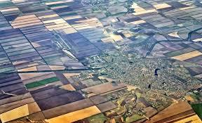
As a result, companies offering aerial imaging services are creating scalable packages for clients in sectors that were previously priced out. For example, small-scale farmers can now use aerial imaging to monitor crop health and optimize irrigation patterns—benefits that were once available only to industrial-scale agricultural operations.
Broadening Accessibility Across Industries
One of the most profound impacts of technological advancements in the Aerial Imaging Market is the way they've opened the door to industries with lower budgets and technical expertise. Real estate agencies now use drone photography to enhance property listings, and local governments leverage aerial imaging for infrastructure assessment, zoning, and disaster response planning.
In environmental monitoring, non-profits and academic institutions use drone imaging for forest mapping, wildlife tracking, and coastline erosion studies. These applications are expanding rapidly, not because the need is new, but because technology has finally made it economically feasible.
Moreover, educational institutions are incorporating aerial imaging into STEM programs, using low-cost drones and open-source software to train the next generation of geospatial professionals.
Market Competition and Innovation
As the cost of entry decreases, more firms are entering the Aerial Imaging Market, spurring further innovation. Companies are now differentiating themselves through value-added services such as real-time analytics, 3D modeling, and integration with enterprise software platforms. Subscription models and pay-as-you-go services are also becoming more popular, enabling clients to use aerial imaging without long-term commitments or high upfront costs.
This competitive environment is excellent for customers—it leads to better service, faster delivery, and reduced pricing. However, it also pushes providers to continuously innovate to maintain margins and stay relevant.
Accessibility Challenges Remain
Despite the considerable improvements, challenges still exist. Regulatory frameworks differ across countries and regions, with some placing restrictions on commercial drone operations or data usage. Connectivity limitations in rural or underdeveloped areas can also hinder real-time data transmission and analysis.
Additionally, while technology has simplified many aspects of aerial imaging, there remains a learning curve. Interpreting complex data outputs still requires some level of technical knowledge, which may deter smaller clients from adopting these tools unless adequate support and training are available.
Looking Ahead
The future of the Aerial Imaging Market is undeniably intertwined with technological evolution. As AI becomes more intuitive, drones more autonomous, and sensors more versatile, the market will continue to grow both in scope and scale. This will likely further decrease costs and expand access, making aerial imaging a fundamental tool for decision-making across nearly every industry.
What was once a luxury for a few is now becoming a utility for many. With each technological breakthrough, aerial imaging is proving itself not just as a visual aid, but as a vital asset in driving efficiency, sustainability, and innovation.