

Agricultural Drones: Enhancing Crop Yield and Sustainability with Modern Practices
Scouting & Monitoring Crops from Above
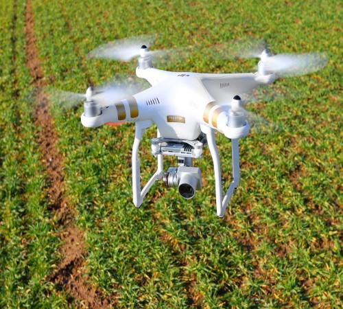
Drones equipped with cameras and sensors allow farmers to closely monitor crop health from a bird's eye view. They can patrol fields to detect problems like diseases, pests, or nutrient deficiencies early on when they are easiest to treat. Thermal and multispectral imaging capabilities reveal moisture levels, plant stress, and other indicators not visible to the naked eye. This helps farmers intervene precisely where needed rather than taking a blanket approach. Drones also monitor crop development over time to analyze growth rates and predict yields. They can survey hard to access areas like steep hillsides. Overall, drones give farmers unprecedented situational awareness of their fields for better decision making.
Targeted Application of Inputs
Precision Agricultural drones take monitoring a step further by enabling accurate, on-demand distribution of agricultural inputs. Drones equipped with spray tanks, seed spreaders, or fertilizer dispensers can apply exact amounts of chemicals, seeds or nutrients only where crops require them as identified by scouting data. Targeted drone-based applications minimize waste and prevent over-application that risks harming the environment, nearby water sources or non-target plants and wildlife. They also save farmers substantial costs on inputs by optimizing usage.
Improving Yield Forecasting
Advanced data analytics of high-resolution multispectral drone imagery allows farmers to develop predictive yield models for their fields. By monitoring real-time field conditions and correlating them with historical yield data, drones help predict harvest volumes with far greater accuracy than traditional methods. This empowers farmers to plan logistics, financing and marketing well in advance. It also enables proactive management if forecasts indicate potential shortfalls from weather, disease or other unforeseen factors. Robust yield forecasting optimizes farm operations and financial planning for increased productivity and profitability.
Advancing Irrigation Practices
Drones assess soil moisture content across fields to pinpoint dry or flooded patches requiring adjustment of irrigation levels. Combined with precipitation and evapotranspiration data, they help farmers determine precise watering schedules tailored to each field’s unique conditions. This conserves valuable water resources while ensuring adequate hydration for optimal crop growth. Drone-enabled “variable rate irrigation” also prevents overwatering that fosters diseases and leaches nutrients from the soil profile. Adopting more precise irrigation practices boosts water efficiency on farms.
Facilitating Sustainable Farm Management
When coupled with robust data management systems, agricultural drones offer a birds-eye view into historical field performance, inputs usage and optimization opportunities. This gives rise to “prescription maps” customized for each field delineating recommended practices tailored to local soil types, topography and other conditions. Prescription maps direct variable-rate applications of seeds, fertilizers and other inputs. They maximize crop productivity sustainably while minimizing agriculture’s environmental footprint over the long run. Coordinated drone data also empowers precision agriculture cooperatives and organizations to monitor vast land holdings efficiently for improved land stewardship
Get more insights on Agricultural Drones