


Aerial Imaging Market applications advancing with AI-powered image processing tools integration
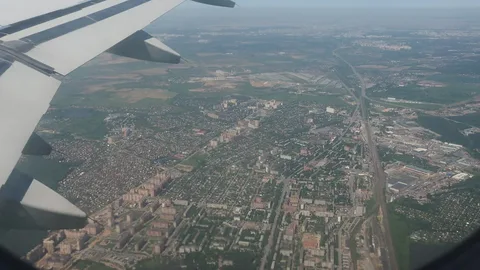
The Aerial Imaging Market is undergoing a major transformation, driven by the integration of artificial intelligence (AI) in image processing workflows. With vast volumes of aerial data being generated daily, AI-powered tools are now essential for extracting actionable insights, automating detection tasks, and expanding the applications of aerial imagery in sectors ranging from agriculture to defense.
The Need for AI in Aerial Imaging
Aerial imaging generates massive amounts of visual data in the form of photographs, videos, multispectral scans, and LiDAR point clouds. Manually analyzing such data is time-consuming, labor-intensive, and prone to human error. AI and machine learning (ML) tools solve this problem by rapidly scanning, classifying, and interpreting aerial imagery with minimal human intervention.
This evolution has not only improved the speed and accuracy of data processing but also enabled entirely new applications where real-time decision-making is essential, such as disaster response, precision agriculture, and autonomous infrastructure monitoring.
Automating Image Analysis for Faster Insights
One of the most transformative applications of AI in aerial imaging is object detection and classification. Whether it’s identifying vehicles in a traffic corridor, counting trees in a plantation, or spotting structural damage on a bridge, AI models trained on annotated aerial datasets can perform these tasks in seconds.
Automation reduces turnaround time from data capture to actionable insight, allowing faster interventions in time-sensitive scenarios. In security operations, for example, AI-driven surveillance drones can detect intrusions or abnormalities instantly, alerting authorities without needing continuous manual oversight.
In urban planning, AI-powered analysis helps map land use patterns, detect unauthorized constructions, and forecast development trends based on historical image data.
Enhancing Accuracy with Deep Learning Algorithms
Deep learning techniques like convolutional neural networks (CNNs) have improved the granularity and precision of image classification. These models can differentiate between similar-looking objects—such as cars versus shipping containers or healthy crops versus diseased patches—at a pixel level.
This accuracy is especially critical in sectors like agriculture and forestry, where minor discrepancies in imaging data can affect large-scale decisions. Farmers use AI-analyzed drone imagery to optimize irrigation, fertilizer application, and pest control strategies.
In construction and mining, AI-enhanced aerial data supports volume calculations, boundary tracking, and hazard detection with superior accuracy, eliminating the need for repeat site visits.
Real-Time Processing and Edge AI Integration
Recent advances in edge computing have enabled AI models to process aerial data in real time directly on the drone or capture device. This reduces dependency on cloud uploads, speeds up decision-making, and enhances performance in remote or connectivity-limited environments.
Edge AI enables drones to adjust flight paths autonomously based on in-flight image analysis—focusing more on areas of interest or avoiding redundant passes. For inspection tasks like monitoring wind turbines, pipelines, or power lines, this capability reduces operational time and improves safety outcomes.
Moreover, real-time AI processing is vital for emergency applications such as wildfire tracking, flood mapping, and search-and-rescue missions, where response time is critical.
Custom Models for Industry-Specific Use Cases
As aerial imaging adoption grows across industries, custom AI models are being developed for niche use cases. In oil and gas, AI detects signs of leakage or corrosion from pipeline imagery. In renewable energy, it helps inspect solar panels and wind blades for surface damage or efficiency loss.
Forestry applications benefit from AI tools that assess canopy health, detect illegal logging, or classify tree species. In real estate, AI-enabled image analysis supports property valuation by measuring lot size, proximity to landmarks, and neighborhood conditions from aerial views.
These customized solutions significantly enhance operational efficiency, allowing stakeholders to make high-confidence decisions based on consistent visual intelligence.
AI-Driven Change Detection and Predictive Analysis
One powerful capability AI adds to aerial imaging is change detection—automatically highlighting differences between two images taken at different times. This is particularly useful in environmental monitoring, asset management, and infrastructure development tracking.
For example, AI tools can flag unpermitted construction, erosion in riverbanks, or expansion of agricultural fields over time. Predictive models can also forecast land use changes, vegetation growth, or urban sprawl using trends learned from historical aerial imagery.
These insights are invaluable for long-term planning, compliance enforcement, and risk mitigation across industries and public agencies.
The Role of Data Annotation and Model Training
To achieve reliable AI performance in aerial imaging, vast quantities of annotated data are required. This has given rise to specialized firms and open-source initiatives that curate training datasets for specific geographic regions, sensor types, and industry applications.
Accurate annotation is key—ensuring that AI models learn the right visual patterns and context. Over time, with reinforcement learning and ongoing data acquisition, these models become smarter, more adaptable, and more robust across different environments and conditions.
Challenges and Ethical Considerations
Despite its benefits, AI in aerial imaging comes with challenges. Model bias, limited data availability for rare use cases, and potential privacy concerns must be addressed through transparent practices and strict data governance.
Additionally, as reliance on automated decision-making increases, human oversight remains essential to validate AI-generated insights, especially in high-stakes industries like defense, public safety, or disaster response.
Conclusion: AI Redefining the Future of Aerial Imaging
The integration of AI-powered image processing tools is revolutionizing the Aerial Imaging Market. It brings speed, precision, scalability, and intelligence to geospatial data applications, opening up new possibilities for real-time monitoring, predictive planning, and automated workflows.
As AI technology continues to evolve, its synergy with aerial imaging will further strengthen industries' capabilities to visualize, interpret, and act on the world from above—making operations smarter, safer, and more sustainable.

 English
 Arabic
 Français
 Español
 Português
 Deutsch
 Türkçe
 Dutch
Dutch
 Italiano
 Romaian